Geospatial
UWEC's geospatial certificate provides you with foundational knowledge in geospatial technologies. Project-based, real-world learning is a focus of the program.
Use Spatial Data to Solve Geographic Problems
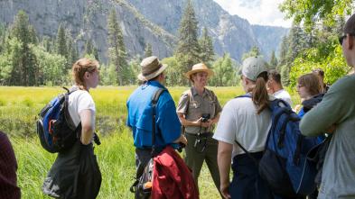
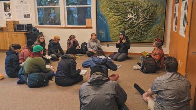
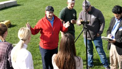
Courses throughout the certificate will introduce you to the fundamental concepts of GIS technology and the utilization of spatial data for solving geographic problems. Project-based, real-world learning is a focus of the program, allowing students to learn field data collection techniques and methods, including those related to GPS and surveying, firsthand.
The 12-credit certificate is available to professionals in the workforce who want to further their education, as well as current UWEC students looking to add a valuable credential to their degree. The ability to specialize your geospatial certificate by pursuing an emphasis in geographic information systems, remote sensing, or mapping is also available.
Program Details

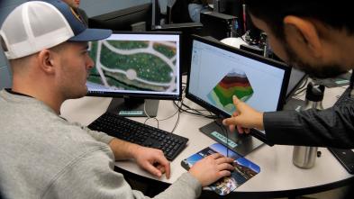
While pursuing your geospatial certificate, you'll have the unique opportunity to work with the same tools, software, and technology professionals use out in the field today. Through field experiences, real-world projects, and cutting-edge research opportunities, you'll gain a working knowledge of core geospatial technology skills, as well as the ethical issues involved with the use of geospatial technology. It’s firsthand experiences like these that set you apart from other candidates when applying for jobs.

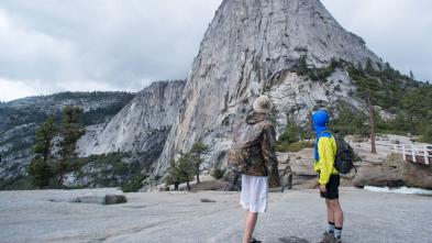
Take what you learn from our expert professors and put it to work in new, exciting locations. Countless opportunities to explore the world around you are available to you at UWEC. Whether you study abroad, partake in cultural immersion programs, participate in the National Student Exchange program or join a student-faculty research project, you'll find ways to take your learning to the next level.
Blugold Stories

Use the same state-of-the-art technology used by industry professionals, spend time in the field, and work with local organizations on real projects and initiatives. UW-Eau Claire's focus on real-world learning gave Haley Christianson the opportunity to work with Eau Claire County and learn how to use high-precision GPS for various mapping projects.


Fascinating coursework — combined with access to current GIS technology — will prepare you for success as you pursue the geospatial certificate at UW-Eau Claire. After completing the program, you'll have gained the knowledge to confidently perform essential geospatial tasks and successfully use industry-standard software and field equipment.
Here are a few courses in Geospatial at UW-Eau Claire.
GEOG 335
Geographic Information Systems I
This course introduces the basic principles and concepts surrounding the use and application of Geographic Information Systems (GIS). Students will learn how to identify, organize, process, and analyze geospatial data representing geographic features of our world. With the use of state-of-the-art GIS technology, this course makes use of geospatial data representing the environment, economy, socio-cultural, political, and other spheres of our world. Moreover, students will learn how to think spatially, produce maps, analyze geospatial data, and communicate spatial information effectively.
GEOG 336
Geospatial Field Methods
Project-based hands-on learning will teach students field data collection techniques/methods for those interested in a career involving geospatial issues. Traditional and advanced geospatial technology are implemented in the course.
GEOG 338
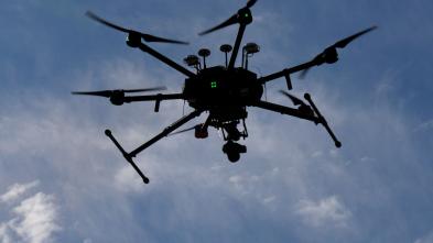
Remote Sensing of the Environment
Descriptive interpretation of remote-sensing images from ground, aerial, and space platforms.
Get More Info
Sign up to receive additional information about our campus.

What's Next?