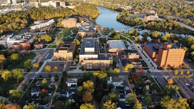
Geospatial Analysis and Technology
Explore the fascinating world of geospatial data and information with the UWEC's geospatial analysis and technology bachelor's degree. An excellent path for those who wish to work in archaeology, climate science, resource planning, or conservation and disaster relief, our comprehensive major will help you find your calling and be successful in your chosen career.
Learn to Work with Geographic Data
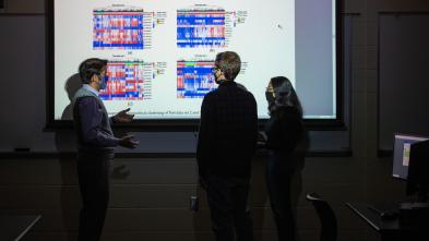
The geospatial field is rapidly growing, making this degree in high demand. Led by expert faculty, you'll learn how to use geographic data to create a visual record of a landscape, examine historic records, and operate cutting-edge geographic information system (GIS) technology.
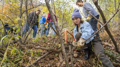
A key component of this program is providing students with applicable, real-world experience. All students majoring in geospatial analysis and technology are required to complete an internship or capstone project. You will also have the opportunity to participate in collaborative, ground-breaking research — right alongside your professors — all over the country. Take your travels a step further by participating in study abroad or the National Student Exchange program.
At UW-Eau Claire, there is no shortage of amazing, interactive learning opportunities. Take advantage of technology-filled labs, innovative curriculum and skill-building student organizations. Here, you'll quickly find that you earn so much more than just a degree. You'll leave with meaningful connections, marketable skills and the opportunity to make a lasting impact on our world.
Program Details

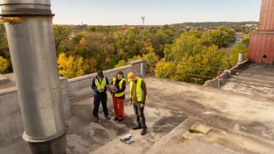
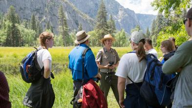
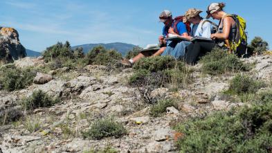
The world is your classroom! Study beautiful natural landmarks right here in Eau Claire, like the Chippewa River, or in Hawai’i or France. Through field and immersion trips, you'll become familiar with the geographer’s fieldwork toolset while using canoes, geoprobes, and zodiac boats and trailers.

Geospatial analysis and technology majors have direct access to some of the field's latest technologies, including global positioning systems (GPS), ground-penetrating radar (GPR), and unmanned aerial systems (UAS), giving you skills and experience highly sought after by employers.

Our faculty’s long-standing relationships with businesses offer consistent and excellent internship openings, giving you the opportunity to develop your resume while pursuing your passion. Previous students have interned at places like Xcel Energy, Michels, and Eau Claire County.

Take advantage of research experiences that will set you apart in the field. Blugolds frequently present their research findings at state and national conferences, giving you the chance to connect with other students and geographers alike.
Blugold Stories
I was touring a bunch of different schools around Wisconsin. I remember my first tour here, I was walking down the hill and my mom and turned and looked at me and she said, "You look really comfortable here. This looks like where you're spending the next four years." And I laughed and joked about it, saying that it was such a cliche and it was cheesy of her to say that. But then I went home, made a pros and cons list, and UW-Eau Claire had a lot of pros and very few cons. It's been a really good decision.


Studying abroad — and having a manager who also studied and lived overseas — allowed me to step outside my comfort zone. This played a huge role in helping me grow professionally and find success working in Germany.

JustThe Facts

Where can the geospatial analysis and technology program lead me after graduation?
Earning a geospatial analysis and technology degree from UW-Eau Claire empowers you to take on many different career paths and opportunities, including graduate school. And because the demand for geospatial skills and knowledge of related technology is growing, graduates are regularly recruited by businesses and industries in Wisconsin and around the world.
Example Careers
- GIS analyst
- UAS/drone systems specialist
- Cartographer
- Remote sensing/LiDAR analyst
- Environmental change specialist
- Geospatial data manager
- Land-use planner
- Land surveyor
UWEC Graduates
Graduates of this program have gone into careers at the following places:
Geospatial Technician
Finley Engineering
Wisconsin
UAS Program Administrator
Ho-Chunk Nation
Wisconsin
Mobile LiDAR Quality Analyst
Continental Mapping
Wisconsin
Geospatial Data and Mapping Specialist/UAS Pilot
Mi-Tech Services
Wisconsin
GIS Services Administrator
Intermountain Rural Electric Association
Colorado
GIS Scientist
Land IQ
California
Senior Engineering Manager
Planet Labs
California
Geospatial Analyst
CACI International
Washington, D.C.
The geospatial analysis and technology program provides engaging, field-oriented learning, helping you to build a solid foundation and understanding of geography. The chance to work with evolving technology, software and tools ensures you are ready to hit the ground running on day one of your chosen career.
Here are a few courses in Geospatial Analysis and Technology at UW-Eau Claire.
GEOG 178
Planet Earth: Conservation of the Environment
This course examines conservation of the environment from a geographical perspective by approaching society’s interdependent relationships with the natural world and its resources. Biophysical, cultural, and socioeconomic issues are addressed in order to better understand environmental problems and develop more effective and sustainable solutions to them.
GEOG 111
Planet Earth: Human Geography
This integrative course examines interactions and relationships between people, places, and environments. It emphasizes how human practices engage with local and global change. The course takes a place-based approach to the analysis of population and health, migration, socioeconomics, identity, language, religion, foodways, economic development, politics, and urbanization.
GEOG 335
Geographic Information Systems I
This course introduces the basic principles and concepts surrounding the use and application of Geographic Information Systems (GIS). Students will learn how to identify, organize, process, and analyze geospatial data representing geographic features of our world. With the use of state-of-the-art GIS technology, this course makes use of geospatial data representing the environment, economy, socio-cultural, political, and other spheres of our world. Moreover, students will learn how to think spatially, produce maps, analyze geospatial data, and communicate spatial information effectively.
Get More Info
Sign up to receive additional information about our campus.


What's Next?